
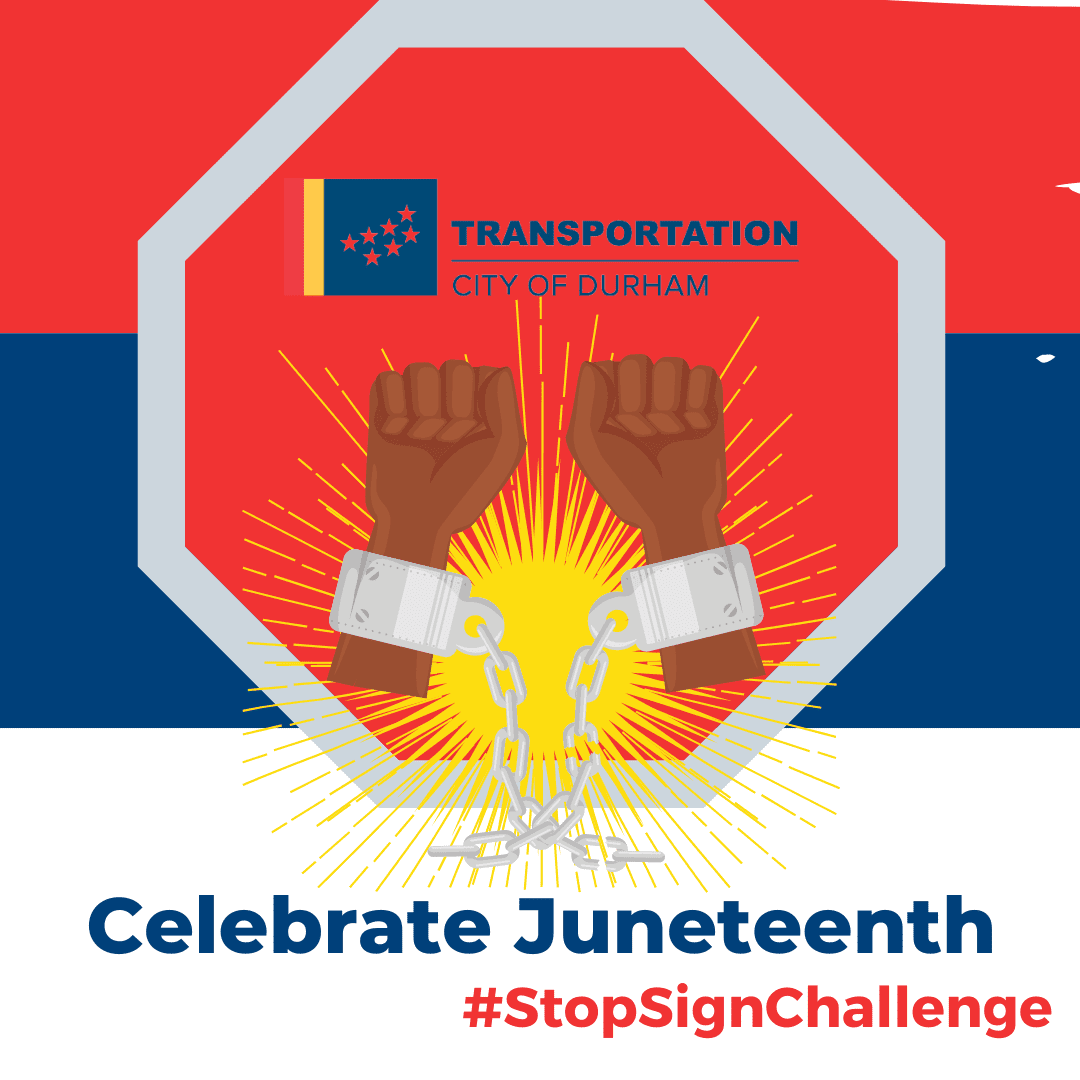
Each year on June 19, we celebrate Juneteenth. This holiday began in 1865 when Major General Gordon Granger informed enslaved people in Texas about the conclusion of the Civil War and the abolishment of slavery. Since 2022, our department has honored the holiday by taking a moment to pause and reflect on our nation’s history through the Stop Sign Challenge. The challenge supports our commitment to ensuring mobility is a service for all. Our department’s Pathways to Connection: Reimagining Durham Freeway (RDF) study embodies the Stop Sign Challenge because it shares our history, promotes healing, and generates action through social change and mobility. Last year, we used this challenge to highlight the beginning stages of RDF. The study has finished its first year of engagement and technical analysis, and this article will share its pathway to new beginnings.
History:
Fifty-five years ago, the first cars drove down NC 147 through Durham, but this land was not always home to a highway. Previously, it represented prominent neighborhoods of the Hayti and Brookstown communities, thriving businesses, and religious institutions owned and operated by the African American population in Durham. The development of the highway, funded by the Federal Government’s Highway Act of 1956, demolished urban and poor Black communities with the promise to rebuild and restore using the Housing and Urban Development’s idea of “urban renewal” through the Housing Act of 1949.
Urban renewal labeled inner city and historically Black communities as “decaying neighborhoods,” negating their history and economic impact. The concept was marketed to community leaders, residents, and business owners as a chance to rebuild what was already established and create a better place to work and live. However, the promises of revitalized communities were never fulfilled once the residents were forced off their properties, surrendering their land to make what we know as the Durham Freeway. NC 147 uprooted 4,000 families and 500 businesses and caused over $300 million (valued at over $3.5 billion in 2025) worth of destruction to the Hayti community. By the late 1960s, an estimated 713 families had been displaced by urban renewal projects in Durham, 74% of which were families of color. Between 1949 and 1973, 2,500 neighborhoods in 933 American cities were bulldozed, displacing one million people.
Study and Its Progress:
The RDF study uses a community-led vision to discuss ideas for Durham Freeway’s future and the surrounding land. Over the last year, the team remained committed to acknowledging the destruction, rebuilding trust from the broken promises of urban renewal, and listening and learning to stories of Durham residents and descendants whose lives and livelihoods were impacted by the freeway. The team participated in numerous events, meeting residents where they are and adding value to their thoughts in the surveys.
Phase One, April to June 2024:
During this time, the team listened to the community’s thoughts on what they knew historically about the freeway, how they use the freeway, how it impacted their lives, what improvements they envision, and how the freeway can be used in the future. The team participated in over 20 community events, interacting with over 1,500 community members and collecting 790 survey responses. We learned the most significant concerns were roadway safety for all users, with improvements to develop a better biking and walking network and using the space to reinvest in the community through businesses. The data collected from Phase 1 allowed the team to create a playbook of strategies to support Durham’s goal of reconnecting neighborhoods along the Durham Freeway. The team identified five focus areas within the corridor.
- History and Belonging: emphasizes building community spaces that respect Durham’s history and culture to create welcoming environments where everyone feels valued with dignity and fairness.
- Mobility: explores improvements to Durham’s transportation network, ensuring safety for all modes of transportation through street design and community connection.
- Safety: explores if residents feel safe within Durham’s transportation network, which can enhance mobility, improve well-being, and provide everyone with equal access to secure and enjoyable travel.
- Sustainability: creates projects that align with Durham’s social, economic, environmental, and cultural needs.
- Equitable Land Use focuses on how the public can better use the land in the NC 147 corridor through real estate development and investing profits back into community institutions.
Phase Two, October- December:
The team began phase two of engagement in a community meeting, asking attendees how the five focus areas can support a community-led vision and which strategies matter most to them. Community members used sticker dots to identify their top three areas for the preferred future concepts.
Each strategy was highlighted in depth, explaining how it can be implemented in Durham through six strategies for each.
History and Belonging:
- Trauma-Informed Design
- Support Programs
- Community-Based Stewardship
- Supporting Black & Brown owned businesses
- Cultural Production Space
- Acknowledgement of History
Mobility:
- Wayfinding & Signage
- Pedestrian Infrastructure
- Improve Traffic Flow
- Reconnect Disconnected Streets
- Bicycle Infrastructure
- Prioritize Active Transportation
Safety:
- Safe Streets and Intersections
- Active Street Fronts (Lighting, Murals)
- Pedestrian and Bike Safety
- Lighting
- Public Spaces and Amenities
- Stewardship Programs
Sustainability:
- Community Informed Mixed-Use Design
- Diversity of Housing Offerings
- Sustainable Sites, Natural Assets, and Urban Forests
- Cultural Preservation
- Urban Agriculture & Community Gardens
- Recycling, Reuse & Circular Economy
Equitable Land Use:
- Community Benefits Agreements (CBAs)
- Reuse Land for Ecosystem Services
- Reduce the footprint of the Freeway
- Public Spaces Bridging Over/Under the Freeway
- Return Reclaimed Land
- Building Over the Freeway
During this meeting, community members also identified the areas they want to focus on. On the map below, 284 locations were marked, and 119 comments were added.
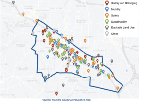
Most comments were placed along the Freeway’s current footprint. Others focused on the Hayti and West End neighborhoods (areas most impacted by the highway). Community members continued expressing their needs for pedestrian improvements to increase connections to resources, local business support, and potential park areas.
Summary Findings:
Phase One and Phase Two used the community’s voice to drive conversations about repurposing the freeway and surrounding areas. Feedback from Phase One emphasized increased mobility and safety, while Phase Two focused on exploring where and how improvements could be implemented in Durham. The Safety and Equitable Land Use Focus Areas were among the top three selected Focus Areas for prioritization.
Where the Team is Today:
The data collected from the surveys and in-person meetings will help identify draft recommendations that will be shared in Phase 3. The prioritization results from the survey and meetings will be incorporated into the alternatives discussion. The feedback and comments provided for the Equitable Land Use Theme will help the study team to consider reimagining the existing Durham Freeway to ensure that safety and mobility guide the development of alternatives and recommendations.
The team is identifying community events to attend over the summer to share the community’s results and solicit more feedback. In August, City of Durham staff will present the findings to the City Council to help further drive the conversation for solutions and next steps.
Every year, we acknowledge Juneteenth as more than a celebration. We use the holiday to empower, educate, and engage the community by talking through our history. Use the Stop Sign Challenge to help you celebrate, educate, and Advocate for the continued push for fairness by sharing the history and our chance to improve it through the Reimagining Durham Freeway Study. Join us as we advocate to create space for greater healing so we can develop more Pathways to Connection.
Sources and Additional Resources:
RDF Engagement Summaries Folder
Defining Urban Renewal and Its Impact on Other Cities
Urban Renewal and the Housing Act of 1949
Highways Deconstructing Black Neighborhoods